Introduction: The Crucible of North American Hydrology and Culture
The Mississippi River has long been recognized as one of the most defining natural features of North America. Its immense length, complex ecological networks, historical significance, and economic influence have woven the river into the fabric of the continent’s identity. Identifying the precise origin point of this colossal watercourse is as much a question of geography as it is a reflection of the historical and ecological narratives that have evolved alongside it. To fully understand the river’s grandeur, one must begin with its humble, yet culturally and ecologically vital, headwaters at Lake Itasca. This glacially carved lake in Minnesota marks the beginning of a journey that spans over 2,300 miles, shaping the landscape, ecosystems, and civilizations it encounters along its way to the Gulf of Mexico.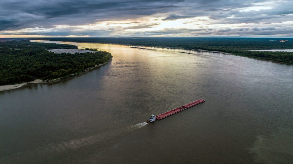

This article, published on freesourcelibrary.com, delves into the extensive depths of the Mississippi River’s origins, course, ecological significance, historical evolution, and ongoing stewardship. It synthesizes scientific insights, ecological principles, and cultural histories to produce a comprehensive portrait of one of Earth’s most fascinating water systems, illustrating its importance from a multifaceted perspective.
The Origin at Lake Itasca: The Birth of a Great River
Geographical Setting and Physical Characteristics
Lake Itasca, nestled within the boundaries of Itasca State Park in Minnesota, stands as the official headwaters of the Mississippi River. Covering roughly 1.8 square miles, this modest-sized glacial lake exemplifies the serenity and pristine nature of the North American wilderness. Its elevation, approximately 1,475 feet (450 meters) above sea level, positions it at a pivotal juncture in the river’s lifecycle, dictating the initial gradient and flow characteristics of the emerging Mississippi.
As a relatively shallow body of water, the lake’s maximum depth does not exceed 40 feet (12 meters). Its calm surface and clear waters serve as a stark contrast to the turbulent downstream sections that will develop later. The source of the Mississippi, while seemingly insignificant at first glance, holds an immense importance due to its position at the confluence of glacial history, hydrology, and ecological processes.
Hydrological Data and Flow Initiation
| Parameter | Measurement |
|---|---|
| Lake Area | Approx. 1.8 sq miles (4.7 km²) |
| Elevation | 1,475 ft (450 m) |
| Maximum Depth | 40 ft (12 m) |
| Initial Discharge | Approximately 500 cubic feet per second (cfs) |
| Width of Small Stream (Headwaters) | About 20 feet (6 meters) |
The river begins as a delicate stream, gradually accumulating volume as it collects runoff, groundwater seepage, and the contributions of localized tributaries. Its flow, initially subtle, encapsulates the complex interplay of geology, climate, and hydrological processes that have fashioned this region over millennia.
The Course: Traversing a Diverse Landscape
From Humble Streams to a Mighty River
Once emerging from Lake Itasca, the Mississippi embarks on a slow, meandering journey, wending through a tapestry of varied landscapes. Its early course passes through mixed forests and wetlands that sustain rich habitats. As the river progresses southward, it broadens and gains momentum, its waters gradually swelling due to tributary inflows.
This initial segment is integral to understanding the river’s ecological richness. The surrounding forests, dominated by deciduous species such as maples, oaks, and cottonwoods, serve as vital buffers, filtering pollutants, stabilizing banks, and offering habitat for diverse species of flora and fauna. These ecosystems, often called riparian zones, are essential to the health of the entire Mississippi system.
Major Tributaries and Enhancements of the Mainstem
The hydrological contribution of tributaries and adjoining waterways greatly influences the flow and character of the Mississippi. Among these, the Missouri River stands out in magnitude and significance.
The Missouri River: The Largest Tributary
The Missouri, originating in the Rocky Mountains, joins the Mississippi near St. Louis, Missouri, in a confluence that dramatically magnifies the river’s volume and complexity. It carries sediment, water, and nutrients from its extensive basin, shaping downstream ecological and physical environments.
Other Influential Tributaries
Including the Ohio, Arkansas, Red, and Illinois rivers, these tributaries cumulatively define the Mississippi River Basin, creating a vast network of waterways that extend into ten U.S. states and parts of Canada. This interconnectedness exemplifies the concept of a fluvial system—that water from vast areas converges into a single channel, linking landscapes and communities in a shared hydrological destiny.
Physical Transformations and River Morphology
The Mississippi’s morphology evolves as it progresses. Initially narrow and swift, it widens into a broader, slower river by the time it reaches Memphis and St. Louis. The floodplains, which are periodically inundated, create dynamic environments, supporting wetlands, agricultural lands, and urban developments.
The Ecological Significance of the Mississippi River and Its Basin
Biodiversity Hotspots and Ecosystem Services
The expansive floodplains and wetlands along the river support an extraordinary diversity of life. Many fish, bird, mammal, and plant species rely on the river’s natural cycles of flooding and drought to thrive. These ecosystems, however, face pressures from human activities like agriculture, urbanization, and hydrological modifications.
Unaltered riparian corridors serve as critical nurseries for fish species such as catfish, bass, and sturgeon. Migratory bird species depend on wetlands along the river for nesting and resting during their seasonal journeys. The ecological services rendered by these habitats include water purification, flood control, carbon sequestration, and nutrient cycling, all of which sustain the health of the broader regions they encompass.
Human Impact and Conservation Efforts
Since the late 19th century, human intervention has significantly altered the natural flow regime of the Mississippi. Levee systems, channelization, and dams have been constructed to facilitate navigation, flood control, and land development. While these modifications have bolstered economic activity, they have also threatened ecological integrity.
Contemporary conservation initiatives aim to restore natural hydrological patterns, protect wetlands, and improve water quality. The Mississippi River and Gulf of Mexico Watershed Nutrient Task Force, for example, strives to reduce nutrient runoff and minimize hypoxia in the Gulf. These efforts underscore the necessity of sustainable management practices recognizing the vital ecological role of the river.
Historical and Cultural Trajectory of the Mississippi River
Indigenous Cultures and Early Exploration
Long before European expeditions, Native American societies thrived along the Mississippi. Indigenous groups such as the Dakota, Ojibwe, Chickasaw, and Choctaw built settlements, cultivated crops, and relied heavily on the river’s resources. The river served as a lifeline for trade, spiritual practice, and migration.
European explorers like Hernando de Soto and Jacques Marquette navigated its waters in the 16th and 17th centuries, driven by ambitions of conquest, trade, and scientific curiosity. These explorations marked the beginning of an intertwined history of colonization, trade, and cultural exchange along the mighty waterway.
The 19th Century: The River’s Role in Expansion and Conflict
The 1800s saw the Mississippi become a vital corridor for westward expansion as steamboat navigation improved transportation and commerce. Cities such as St. Louis, Memphis, and New Orleans flourished as hubs of trade, their growth deeply tied to the river’s navigability.
The river also played a strategic role during the Civil War, with key battles and campaigns fought along its banks. Control of the Mississippi was pivotal for commanding transportation and supply routes, shaping the outcome of the conflict and the future of the nation.
Industrialization and Modifications
As industrialization intensified, efforts to regulate and harness the river’s power intensified. Construction of dams, levees, and locks enhanced navigation and flood control but also led to ecological challenges. These modifications often increased sedimentation, reduced habitat heterogeneity, and contributed to environmental degradation.
Modern Challenges and Stewardship
Environmental Threats and Pollution
The 20th and 21st centuries have brought increased environmental challenges. Agricultural runoff rich in nitrogen and phosphorus leads to hypoxia in the Gulf, affecting marine life and local fisheries. Industrial pollution, urban wastewater, and oil spills have further compromised water quality.
Addressing these issues involves policies and initiatives such as the Clean Water Act and various conservation programs aimed at restoring water quality, reducing nutrient loads, and improving ecological health.
Flood Management and Infrastructure
Flooding remains a persistent threat, especially during catastrophic weather events intensified by climate change. The complex system of levees and dams, while mitigating flood risks, also alters natural flood regimes, reducing sediment deposition crucial for delta sustainability. Adaptive management and technological innovation are central to balancing flood control with ecological integrity.
Climate Change and Future Outlook
Climate change influences the hydrology of the Mississippi Basin through altered precipitation patterns, increased storm intensity, and rising sea levels impacting delta regions. Anticipating these changing conditions requires resilient infrastructure, ecosystem-based management, and international cooperation to ensure the river’s sustainability.
The Mississippi River Delta: The Final Chapter
Ecology and Landform Dynamics
The delta, where the river meets the Gulf of Mexico, is a dynamic environment shaped by sediment deposition, tidal influences, and storm activity. It hosts a rich mosaic of wetlands, estuaries, and barrier islands that support fish, bird species, and other wildlife.
However, the delta is under threat from subsidence, sea-level rise, and human interventions that disrupt natural sediment delivery, leading to land loss. Restoration projects focus on sediment management, wetland conservation, and resilient infrastructure to protect this vital ecological and economic zone.
Nutrient Contributions and Coastal Ecosystems
The Mississippi carries nutrients that sustain the productivity of the Gulf, supporting fisheries and coastal ecosystems. These nutrients, while beneficial, can also exacerbate algal blooms and dead zones, creating complex environmental challenges that require integrated management strategies.
Conclusion: An Interwoven Legacy of Nature and Humanity
The origin of the Mississippi River at Lake Itasca signifies more than a geographic starting point. It symbolizes the intertwining of geological history, ecological diversity, human endeavor, and cultural evolution. The river’s journey from a modest glacial lake to a mighty, life-giving artery underscores the profound interconnectedness between natural processes and human civilization.
As stewards of this vital resource, current and future generations must pursue balanced strategies—embracing conservation, sustainable development, and scientific innovation—to preserve the Mississippi’s legacy. Its waters continue to flow not only through landscapes but also through the collective consciousness of the continent, embodying resilience, connectivity, and the enduring power of nature’s design.
Sources: U.S. Geological Survey (USGS), “Mississippi River Hydrology,” 2022; National Park Service, “Itasca State Park and the Source of the Mississippi,” 2023.